Posts

Showing posts with the label GPS Navigation

Using a GPS for Navigation

Image
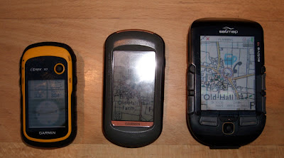
Using a GPS for Navigation I consider myself to be a skilled navigator, a bit of a nerd when it comes to map reading and using a compass along with all of the skills and techniques that make up navigation. At Peak Navigation Courses we are teaching map reading and navigation most weekends throughout the year. On almost every course I am asked, ‘do you use a GPS?’   Well the answer is, “yes sometimes.”   (This blog is part 1 of 2. In the 2nd blog we willwrite about which GPS to choose ). A range of GPS devices: Garmin Eurex 10, Garmin Oregon 650, Garmin 64s and Satmap Active 10. Walk Highlands GPS Planner on my lap top I liken it to having a.b.s. or powered steering in my car. I wouldn’t drive a car without if I had the choice. For me, owning and being able to use a GPS device is another tool in my toolbox of navigation techniques. If I am working in remote places, big mountains or going out in poor conditions them I’ll put my GPS in the top of my rucksack...

Which GPS for Hill Walking?

Image
Choosing a GPS (for Hill Walking) At Peak Navigation Courses we run sessions to help people get to grips with their GPS most weeks. We are often asked which GPS device is the best or which GPS should I buy? Sometimes we are challenged by people arguing that their smart phone is as good or better than a dedicated GPS device. We always try to give an unbiased view, and in this blog we shall attempt just that, however, our experience is limited to Garmin, SatMap and ViewRanger. The Smart Phone / View Ranger. I’ve had View Range r on my Phone and smart phone for many years and though I find its functions as good (and possibly even better) as any dedicated GPS device, I’d never rely on it when the chips are down. Most mobile phones have poor battery life and don’t run View Ranger for more than 8 hours. Phone’s are not usually shock proof, dust proof or water resistant. Great in good conditions. If you do decide to go for this option, invest in a good quality case and ...

Hill and Mountain Skills Courses

Image
Hill and Mountain Skills Courses Peak Navigation are keen to promote hill and mountain safety and enable people to enjoy getting out into the hills safely. Our hill and mountain skills training courses are available both for those new to hill walking and as a "refresher" for the more experienced. The courses includes: Mountain Safety, Weather and Equipment; Navigation, using a map and compass, route choice and using a GPS.  This 4 day course is based in The Peak District.  Details can be found on the Peak Navigation Courses website. The 7 day Mountain Skills course is  based in Spain's Sierra Nevada Mountains and additionally includes scrambling and some rope work. This is both valley based and hut based (1 or 2 nights) including ascents of Mulhacen and Alcazaba. Cost from £550 depending on your choice of accommodation and includes your pick up from malaga Airport and final drop off.  Further details can be found on our  website Sierra Nevad...

Which GPS for Hill Walking?

Image
Choosing a GPS (for Hill Walking) A friend recently asked me this question as someone involved in organising GPS training courses that can be trusted to give an unbiased view. However, even being objective and unbiased I could only provide an answer within my experience (being confined to Garmin, SatMap and ViewRanger). The Smart Phone / View Ranger. I’ve had View Ranger on my Phone and smart phone for 5 years and though I find its functions as good or better than any proper GPS device (easier to use and better functions) I’d never rely on it for when the chips are down. Phones have poor battery life and don’t run View Ranger for more than 8 hours. Phone’s are not usually shock proof, dust proof or water resistant. Great in good conditions.  Keep your phone in tact with the batteries fully charged in case you need to summon help! GPS Devices. You need to make a choice: firstly do you want one that has OS mapping installed or one with out? Secondly if you have chosen ...