Using a GPS for Navigation
Using
a GPS for Navigation
I consider myself to
be a skilled navigator, a bit of a nerd when it comes to map reading and using
a compass along with all of the skills and techniques that make up navigation.
At Peak Navigation Courses we are teaching map reading and navigation most weekends
throughout the year. On almost every course I am asked, ‘do you use a
GPS?’ Well the answer is, “yes
sometimes.” (This blog is part 1
of 2. In the 2nd blog we willwrite about which GPS to choose).
 |
| Walk Highlands GPS Planner on my lap top |
 |
| View Ranger with mapping of Gran Canaria on my iPad |
The other nice thing
about using a GPS is that you can make a track of where you have been. This
means that once you have finished your route you can see how far you have
walked and where you have been on the computer screen.
There have been some memorable moments where I have resorted to using a GPS from my map.
 |
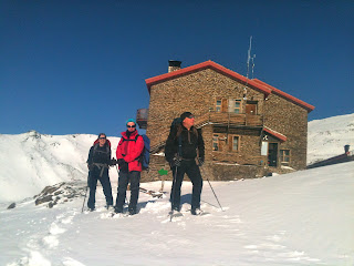
| Leaving the Refugio Poqueira, no need for a GPS! |
 |
| An hour later, time for the GPS! |
Another question I am frequently asked is what type of GPS should I get? Well that’s the content of another blog. However I’ve been using a GPS for over 10 years. In those days they didn’t come with mapping. Even when they did and although we have several with mapping I hung onto my basic old Garmin Etrex as all I wanted from it was a grid reference of where I was. It’s only been in the last 12 months that I have gradually changed my opinion. Most devices now have the ability to install mapping onto them and they have generally got a lot easier to use. I no longer want to spend 5 minutes typing a grid reference into my old ETrex as I now have the choice of touching the place on the map (with a touch screen device) that I want to go to then pressing a button to navigate. 2 presses of a finger taking only 2 or 3 seconds! It’s a similar process with the new button press devices, move the cursor using the joystick to where you want to go to then 2 presses of the button and you are navigating. Slick.
 |
| Garmin 64s a good device |
If you are thinking of
getting a GPS but are unsure which is the right one for you, you can book a
session with us and we’ll show you how they work and let you try them out.
These popular 1:1 half day sessions cost only £60. They are also suitable for getting started if you have just
acquired one but are uncertain about using it.
The course is called: Making the most of your GPS.
The course is called: Making the most of your GPS.
• What the
buttons do and the menus are for…..
• Finding out
where I am and relating it to the map.
• Creating
waypoints and making a route.
• Making a track
of where I am walking.
• Getting information
about where I have walked and plotting it on your P.C.
• Using online
programmes to plan a route and transfer it to your GPS.
• Downloading
routes from the internet onto you GPS and following them.
• What is
geocaching and how do I do it?
Mike and Jane who run Peak Navigation Courses are both International Mountain Leaders
who in addition to running navigation courses lead walking holidays in various
mountainous regions around the world.


