Posts

A Glorious Night Out!

Image
A Glorious Night Out! The weather over the past weekend was one of forecasts for heavy rain and flooding across the country. Amidst this Peak Navigation Courses still managed to run a successful night navigation course that was acclaimed as brilliant by the students attending! “Thanks for last nights night nav session. Really enjoyed it!”   Ashley Dawson Night Navigation, planning strategies The night navigation courses are really designed for people who already have good navigation skills and are able to use a map and compass to cross open moorland. What they aim to achieve is to introduce the necessary strategies to cope in poor visibility simulating what happens should the mist come down or should you get caught out after darkness. Hopefully the course will leave students confident to get out and practice for themselves (practice makes perfect!). The course we run starts at 6.30pm during the winter months and involves a practical session of around three h...

Map Reading and Navigation Courses make great Christmas Presents!

Image
Map Reading and Navigation Courses make great Christmas Presents! Peak Navigation Courses run map reading and navigation courses throughout the year.   Our peak demand season is the months of January, February and March. This is due to a variety of reasons: New Years resolutions to get fit or get out walking; people wanting to learn navigation ahead of a walking holiday planned as their summer holiday;   and people in receipt of our courses as a Christmas present. What a great idea giving a Map Reading and Navigation Course as a Christmas present! Map Reading and Navigation Course   Here’s a list of our courses: Introduction to Map Reading Course First Steps to Map Reading and Navigation    £40 A 1 day course, which will set you up with the basics of using a map and compass over easy open moorland. An Introduction to Moorland Navigation          £40 A 1 day course, designed for people wh...

Map Reading and Navigation Courses in The Derbyshire Peak District.

Image
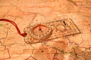
Map Reading and Navigation Courses in The Derbyshire Peak District. Dark Peak Map and Silva type 4 Compass Being able to read a map and to navigate gives you the freedom to plan your own routes and give up using books of walks.   Scouring the map finding places of interest then planning your own route is so much more rewarding than following a book! Take for example Bamford Moor in the Peak District, it has two stone circles but no path marked on the map to either of them.   If you know how to read a map you can make a fabulous circuit from Ladybower’s Heatherdene car park and visit them with stunning views over the reservoirs, Win Hill and the Derwent Valley. Peak Navigation Courses run two introductory level Map Reading and Navigation Courses that will leave you equipped for planning and undertaking such a route: 1 st Steps to Map Reading and Navigation 1st Steps to Map Reading and Navigation Course A Day courses taking you from the very bas...

Map Reading and Navigation Course

Image
Map Reading and Navigation Course I’m constantly amazed at the frequency that I’m approached on Kinder Scout by people who are lost and want directions to get back down safely.   I don’t mind this but it usually happens when I’m running a navigation course! Map Reading Course, Kinder Scout People book onto our map reading and navigation courses for a variety of reasons, many because they have been “misplaced” and want to make sure that it doesn’t happen again.   Peak Navigation Courses offer a range of courses from absolute beginner to “master classes” designed to provide handy revision to experts in need of a challenge. Our basic level course, 1 st Steps to Map Reading and Navigation covers all the basics, spending about 1.5 hours in the class before heading out for a short walk putting it into practice.   A further session in the classroom over lunch helps us prepare a route card before heading up onto some local moorland to navigate with a ...

Night Navigation

Image
Night Navigation and Poor Visibility Navigation Course Most of us who have been walking in the hills and mountains have experienced the mist coming down. Also in Britain once the clocks change in the autumn, it seems as if there are fewer daylight hours and it is not uncommon to see people returning from their walk after it is dark. On Kinder Scout in the mist Whether you are caught in the mist or end up coming down in the dark, it is useful to have practiced in poor visibility beforehand. Map reading and navigation in poor visibility, especially off path across open ground requires slightly different techniques and strategies.   It is harder to interpret the “contours” around us and if navigating in a straight line using a compass we need greater precision and strategies using “handrails” and “catching features.”   In situations like this pacing and timing play a more vital role in telling us where we are. Knowing just how many paces you take to a hund...

Kinder Scout claims more scalps!

Image
Autumn has arrived early this year as we didn’t seem to have much of a summer. Looking at the mountain rescue call out reports, the Peak District moors have certainly been proving too much for many ill prepared walkers who have ended up having to be rescued.   It’s not just about poor map reading and navigation skills and the over reliance on GPS navigation technology, but also about having the skills, clothing and equipment to deal with the difficult terrain, which has become extremely boggy after the summer rains.  The Following is an extract from Buxton Mountain Rescue Team call out log: “ Buxton Mountain Rescue Team called out as night fell to search Kinder moor for two walkers who were trapped by deep bog without lights or whistle.   Although the casualties, a married couple from Doncaster, had no apparent injuries, they were very cold and disorientated. The night was damp and misty at high level, with some wind. They had set off for a days walk from E...

Navigation Courses

Image
Each year, autumn sees an increase in people booking onto our navigation and map reading courses . We like to think that this is in preparation for winter where shorter days and the chance of poor weather can be more of a challenge if someone were to get misplaced in the mountains or on the moors. However the reality is that a significant number of people go out walking over the summer, enjoy it but get a bit lost. It’s this group that provide the majority of our autumn bookings. Introduction to Moorland Navigation Course Peak Navigation Courses provide a range of map reading courses and navigation courses from complete beginner to expert standard where people attend to refine or revise their skills.  Our Introduction courses both start with around 1.5 hours spent in the classroom (Foolow Village Hall) which is then followed by a walk taking in a range of landscapes that includes both open moorland and fields.  Both Introductory courses teach the basics of navi...