Posts

Showing posts with the label Map Reading

How to use a Compass

Image
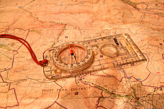
How to use a compass A compass is a simple and brilliant navigation tool.  At the very least it will have a needle that points north which will allow you to orientate your map and give you a rough indication of which way to walk.  If you have one designed for hill walking, mountaineering and orienteering then you will have "the full monty" and be able to use it for accurate map reading and navigation.  The compass used to illustrate this blog is a Silva type 4 Expedition (not the military version) and is a great all round compass. In this short feature I can't teach you all of the techniques involved in navigation but will show you how to use a compass to navigate across a short stretch of open moorland from a known point (where you are) to another point (where you want to go). Step 1: I want to navigate from the Trig Point 590m to Madwoman's Stones. Step 2: Lay the edge of the compass across the Trig Point 590m and Madwoman's ...
AZ Adventures 1:25000 scale maps for walkers

Image
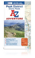
Only a few minutes before the start of our last First Steps to Map Reading course , Mike walked into the training room with a small package. "You might like this" he said, passing it over to me. On opening I discovered 2 AZ Adventures booklets of 1:25000 Peak District mapping, together with case and lanyard. Thanks to the wonders of social media, I had been offered these to review.  During this particular course, I talk about the various mapping options available to walkers, and had often mentioned the AZ maps, but never actually bought one.  I included them in the list that morning, and the group of relatively experienced walkers were quite impressed, and I have to say so were we. So what makes AZ Adventures different?  The most obvious is that in keeping with AZ a pedigree, these are uniquely in a book or atlas format, which means no wrangling with large cumbersome maps, a wonderful bonus when it is blowing a gale out in the hill. This does mean you have to...

New Season of Map Reading and Navigation Courses

Image
Our first Map Reading and Navigation course of the Autumn 2013 season got off to a successful start, with 9 participants, one of whom continued to our Intermediate Course the following day, and as a result achieved his Silver National Navigation Award . Despite an uncertain weather forecast, it stayed dry and mostly sunny offering great views from Longstone Moor during the afternoon, when we were able to put those new found skills of reading the map and using the compass to the test. There are plenty of places left on Peak Navigation courses during November, so if you know anyone who may be interested, do pass on the details.

Foreign Maps

Image
BL***Y Foreign Maps Mike and Jane from Peak Navigation Courses spend the summer months guiding people in the mountains. This summer will see us in Spain’s Sierra Nevada, Swaziland, Mozambique, Scotland and Slovenia. As International Mountain Leaders we are trained and assessed at using all sorts of foreign maps.   We have a lot to be thankful for in the U.K. as our Ordnance Survey maps are perhaps the best in the world. It also makes navigation easier with good maps and makes for safer enjoyment in the mountains. Map extract - Spain's Sierra Nevada In the UK our maps show crags and rock features. This is especially useful as you wouldn’t want to take a line over a cliff.   The map above is from Spain’s Sierra Nevada.   From the contour lines it appears that these are nice rounded hills with no crags at all.    The cliffs at point A on the map The next pictures below show Jane climbing / scrambling at points A and B on the map! Not...

Map Reading and Navigation Courses in The Derbyshire Peak District.

Image
Map Reading and Navigation Courses in The Derbyshire Peak District. Dark Peak Map and Silva type 4 Compass Being able to read a map and to navigate gives you the freedom to plan your own routes and give up using books of walks.   Scouring the map finding places of interest then planning your own route is so much more rewarding than following a book! Take for example Bamford Moor in the Peak District, it has two stone circles but no path marked on the map to either of them.   If you know how to read a map you can make a fabulous circuit from Ladybower’s Heatherdene car park and visit them with stunning views over the reservoirs, Win Hill and the Derwent Valley. Peak Navigation Courses run two introductory level Map Reading and Navigation Courses that will leave you equipped for planning and undertaking such a route: 1 st Steps to Map Reading and Navigation 1st Steps to Map Reading and Navigation Course A Day courses taking you from the very bas...

Map Reading and Navigation Course

Image
Map Reading and Navigation Course I’m constantly amazed at the frequency that I’m approached on Kinder Scout by people who are lost and want directions to get back down safely.   I don’t mind this but it usually happens when I’m running a navigation course! Map Reading Course, Kinder Scout People book onto our map reading and navigation courses for a variety of reasons, many because they have been “misplaced” and want to make sure that it doesn’t happen again.   Peak Navigation Courses offer a range of courses from absolute beginner to “master classes” designed to provide handy revision to experts in need of a challenge. Our basic level course, 1 st Steps to Map Reading and Navigation covers all the basics, spending about 1.5 hours in the class before heading out for a short walk putting it into practice.   A further session in the classroom over lunch helps us prepare a route card before heading up onto some local moorland to navigate with a ...

Night Navigation

Image
Night Navigation and Poor Visibility Navigation Course Most of us who have been walking in the hills and mountains have experienced the mist coming down. Also in Britain once the clocks change in the autumn, it seems as if there are fewer daylight hours and it is not uncommon to see people returning from their walk after it is dark. On Kinder Scout in the mist Whether you are caught in the mist or end up coming down in the dark, it is useful to have practiced in poor visibility beforehand. Map reading and navigation in poor visibility, especially off path across open ground requires slightly different techniques and strategies.   It is harder to interpret the “contours” around us and if navigating in a straight line using a compass we need greater precision and strategies using “handrails” and “catching features.”   In situations like this pacing and timing play a more vital role in telling us where we are. Knowing just how many paces you take to a hund...

Kinder Scout claims more scalps!

Image
Autumn has arrived early this year as we didn’t seem to have much of a summer. Looking at the mountain rescue call out reports, the Peak District moors have certainly been proving too much for many ill prepared walkers who have ended up having to be rescued.   It’s not just about poor map reading and navigation skills and the over reliance on GPS navigation technology, but also about having the skills, clothing and equipment to deal with the difficult terrain, which has become extremely boggy after the summer rains.  The Following is an extract from Buxton Mountain Rescue Team call out log: “ Buxton Mountain Rescue Team called out as night fell to search Kinder moor for two walkers who were trapped by deep bog without lights or whistle.   Although the casualties, a married couple from Doncaster, had no apparent injuries, they were very cold and disorientated. The night was damp and misty at high level, with some wind. They had set off for a days walk from E...

Navigation Courses

Image
Each year, autumn sees an increase in people booking onto our navigation and map reading courses . We like to think that this is in preparation for winter where shorter days and the chance of poor weather can be more of a challenge if someone were to get misplaced in the mountains or on the moors. However the reality is that a significant number of people go out walking over the summer, enjoy it but get a bit lost. It’s this group that provide the majority of our autumn bookings. Introduction to Moorland Navigation Course Peak Navigation Courses provide a range of map reading courses and navigation courses from complete beginner to expert standard where people attend to refine or revise their skills.  Our Introduction courses both start with around 1.5 hours spent in the classroom (Foolow Village Hall) which is then followed by a walk taking in a range of landscapes that includes both open moorland and fields.  Both Introductory courses teach the basics of navi...

A Summer of testing navigation!

Image
The only good point about the British “Summer” that we have been experiencing is that it’s been testing the navigation skills of those visiting the moors and mountains.   With all the low cloud, rain, drizzle and wind, visibility has been poor on more days than not. This is why it’s essential to know how to map read and navigate. Peak Navigation Courses provide a range of navigation training from the complete novice up to the expert wanting practice for undertaking Mountain Leader assessments. Peak Navigation Courses Autumn Programme is now available.

Peak Navigation Courses

Image
Well our Spring season ofMap Reading and Navigation Courses is drawing to a close.   This year we have put on additional courses due to demand and the positive feedback we have received has been great.   It’s been wonderful for us too, as ever making new friends and even learning a thing or two from our students. One of the highlights was discovering the compass that pointed south! Peak Navigation Courses are now running Hill Skills Courses based in the Peak District looking at a complete range of skills: Mountain Safety, Weather, Equipment, Navigation, GPS Navigation, Scrambling and Ropework. Photo’s of this years courses are also on the website.   Check them out to see if you are there.   If you have any pictures from your course that we could use, please send them in. With our other company, Sierra Nevada Guides we are also running Mountain Skills Courses based in Spains Sierra Nevada .   This course builds on the navigation you’ve lear...

Hill and Mountain Skills Courses

Image
Hill and Mountain Skills Courses Peak Navigation are keen to promote hill and mountain safety and enable people to enjoy getting out into the hills safely. Our hill and mountain skills training courses are available both for those new to hill walking and as a "refresher" for the more experienced. The courses includes: Mountain Safety, Weather and Equipment; Navigation, using a map and compass, route choice and using a GPS.  This 4 day course is based in The Peak District.  Details can be found on the Peak Navigation Courses website. The 7 day Mountain Skills course is  based in Spain's Sierra Nevada Mountains and additionally includes scrambling and some rope work. This is both valley based and hut based (1 or 2 nights) including ascents of Mulhacen and Alcazaba. Cost from £550 depending on your choice of accommodation and includes your pick up from malaga Airport and final drop off.  Further details can be found on our  website Sierra Nevad...