Posts

Showing posts with the label Map Reading Course

Using a Compass for Map Reading and Navigation

Image
Using a Compass for Map Reading and Navigation She's got it! Using a compass 1st Steps to Map Reading & Navigation Course It’s a commonly held misconception that a compass is only useful for navigating across open moorland, mountain terrain or in the mist.   Additionally many people carry a compass but do not know how to use it! We have been living and working in the Peak District for many years teaching Map Reading and Navigation. Frequently we watch people park up un the village green opposite our house get togged up for a walk and set off, only to see them coming back 5 or 10 minutes later as they had initially set off in the wrong direction. This is especially true of young people on their Duke of Edinburgh’s Award expeditions. Using a compass to “orientate” your map before setting off helps you to then recognise where features are on the ground (preferably using a 1:25k scale map) and therefore which way to leave the car park or village. With ...

How to use a Compass

Image
How to use a compass A compass is a simple and brilliant navigation tool.  At the very least it will have a needle that points north which will allow you to orientate your map and give you a rough indication of which way to walk.  If you have one designed for hill walking, mountaineering and orienteering then you will have "the full monty" and be able to use it for accurate map reading and navigation.  The compass used to illustrate this blog is a Silva type 4 Expedition (not the military version) and is a great all round compass. In this short feature I can't teach you all of the techniques involved in navigation but will show you how to use a compass to navigate across a short stretch of open moorland from a known point (where you are) to another point (where you want to go). Step 1: I want to navigate from the Trig Point 590m to Madwoman's Stones. Step 2: Lay the edge of the compass across the Trig Point 590m and Madwoman's ...

AZ Adventures 1:25000 scale maps for walkers

Image
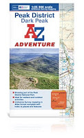
Only a few minutes before the start of our last First Steps to Map Reading course , Mike walked into the training room with a small package. "You might like this" he said, passing it over to me. On opening I discovered 2 AZ Adventures booklets of 1:25000 Peak District mapping, together with case and lanyard. Thanks to the wonders of social media, I had been offered these to review.  During this particular course, I talk about the various mapping options available to walkers, and had often mentioned the AZ maps, but never actually bought one.  I included them in the list that morning, and the group of relatively experienced walkers were quite impressed, and I have to say so were we. So what makes AZ Adventures different?  The most obvious is that in keeping with AZ a pedigree, these are uniquely in a book or atlas format, which means no wrangling with large cumbersome maps, a wonderful bonus when it is blowing a gale out in the hill. This does mean you have to...

Choosing a Navigation Course

Image
Peak Navigation Courses,   Which is the Right Course For   Me? At Peak Navigation Courses we want you to have the best learning experience and select the right course so that you get the greatest benefit. Hopefully this Blog will answer your questions.  We run a range of stand alone courses in both traditional (map and compass) navigation and some 1:1 training to get you started with your GPS. Additionally, our Introductory Course (1st Steps to Map Reading & Navigation) can be combined with our Intermediate Course (Moving onto Moorland) to become the Silver National Navigation Award. Intoductory Course - 1st Steps to Map Reading & Navigation Prior Experience.             None required. Classroom based with 2 short walks of 1.5 hours and 2 hours. Terrain encountered.             Paths, fields and some rough pasture on easy mo...

Learning Map Reading and Navigation

Image
Map Reading and Navigation Courses Being able to navigate accurately through the countryside, moorland and mountains is an essential skill that all walkers should have if they want to stay safe. Navigation Training on Eyam Moor Looking at the different maps for walkers Having the ability to look at a map and plan a route, knowing what the map is telling you about the terrain and having a good idea of how long it will take to walk the route are good map reading skills.   Navigating efficiently around the planned route takes the skills on a stage further. All of these skills can be self taught through books, videos and practice. However learning from experts can give you added knowledge and the benefit of years of experience and topical advice (i.e. which way to get out of the car park or what to do when the map shows one path but on the ground there are two). Successfully Using a Compass to Navigate At Peak NavigationCourses we have a range of...

Night Navigation Courses

Image
Night Navigation Courses Being caught out whilst walking either in the dark or in the mist can be a frightening experience unless you have learnt the skills and strategies to cope with such eventualities. The Joys of Night Navigation Practice Trig Points make a good map table Of course being able to map read and navigate using a map and compass are essential skills for safe walking the hills and mountains. It is only a short step from being a competent daytime navigator to being able to cope with navigating in poor visibility.  Also, like with any skill set, it is a good idea to get out and practice occasionally to ensure that you still have the confidence to navigate in the dark or the mist. Anyway, Night Navigation is fun and certainly a good alternative to staying in and watching t.v.!! Challenging Moorland on "Big Moor" With the nights drawing in, Peak Navigation Courses have a programme of short evening courses aimed at teachin...

Map Reading for Mature Walkers

Image
Map Reading for Mature Walkers At Peak Navigation Courses we are seeing an increasing number of “mature” walkers attending our map reading and navigation courses. People come into walking for various reasons, some are taking it up in retirement, others come via the “walks for health” programme though many have walked as part of a group for many years but have always followed others and now want to plan and follow their own routes.   Whatever your reason for wanting to learn to read a map and navigate, Peak Navigation Courses have a course to suit you. This is why we are introducing a course specifically for mature walkers who want to enjoy walking paths and lanes at a slower pace rather than crossing open moorland. Map Reading for Mature Walkers is a one day course that starts with the very basics though by the end of the day aims to leave you confident to plan a route and follow it using a range of map reading and navigation techniques including using a c...

Learn Map Reading and Navigation in The Peak District

Image
Learn Map Reading and Navigation in The Peak District Whether you are a seasoned walker, a complete novice or someone who has for years followed others, Peak Navigation Courses have a course for you! For the past ten years we have been delivering training from our base in The Peak District and occasionally further afield in the mountains of Snowdonia and The Lake District. 1st Steps to Map Reading and Navigation Entry Level: Most people come for the one day 1st Steps to Map Reading and Navigation Course . It doesn’t matter if you are a complete novice or have some experience, this course starts with the very basics and leaves you able to cross easy open moorland using a compass. A great day out. National Navigation Awards: Some come to us wanting to gain an award under the National Navigation Awards Scheme. We highly recommend that adults can come straight in at Silver level not needing to have gained a Bronze Award first. This is a 2 day cours...

Map Reading and Navigation Courses in The Peak District

Image
Peak Navigation Courses, Autumn programme 2014 1 st Steps to Map Reading and Navigation (Silver NNAS Day 1) Our “entry level” course suitable for the novice or those with plenty of experience who want to learn properly to navigate through fields and easy open moorland using a map and compass. (This course also forms day 1 of our Silver National Navigation Award Courses and is undertaken with “Moving onto Moorland” to complete the award).  Based from Foolow in The Peak District, a one day course costing £40. Dates: Saturday 6 th September Saturday 11 th October Saturday 25 th October Saturday 8 th November Sunday 23 rd  November Moving onto Moorland (Silver NNAS Day 2) This course is for more experienced navigators who already understand how to use a map and compass but want to progress onto moorland. The course introduces “micro” navigation techniques such as pacing and timing on a compass bearing. (This course also forms day ...