Posts

Choosing a compass to get the best out of your Peak Navigation Course

Image
At Peak Navigation Courses , we pride ourselves in our compass navigation, getting a real thrill out of sharing map and compass navigation techniques with others Whether you are a complete beginner or joining one of our advanced navigation courses where we use the compass to cross Kinder Scout, choosing the best compass for you can be a real minefield. Go to one of the outdoor or online shops and you will find a sometimes bewildering array of different compasses, so which is best, and how do you choose? If you are a new hill walker, or never used a compass before, a cheaper model is often appealing.  You can pick a compass up from an online shop for a couple of pounds, but is it worth it? Highlander Summit As a starter compass, this may seem appealing, it is light, easy to carry and will point north. However the plastic base is very short, and lacks an arrow to show which direction you should walk - not one we would recommend. Vango DLX0 The Vango DLX is a reas...

How to use a Compass

Image
How to use a compass A compass is a simple and brilliant navigation tool.  At the very least it will have a needle that points north which will allow you to orientate your map and give you a rough indication of which way to walk.  If you have one designed for hill walking, mountaineering and orienteering then you will have "the full monty" and be able to use it for accurate map reading and navigation.  The compass used to illustrate this blog is a Silva type 4 Expedition (not the military version) and is a great all round compass. In this short feature I can't teach you all of the techniques involved in navigation but will show you how to use a compass to navigate across a short stretch of open moorland from a known point (where you are) to another point (where you want to go). Step 1: I want to navigate from the Trig Point 590m to Madwoman's Stones. Step 2: Lay the edge of the compass across the Trig Point 590m and Madwoman's ...

AZ Adventures 1:25000 scale maps for walkers

Image
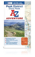
Only a few minutes before the start of our last First Steps to Map Reading course , Mike walked into the training room with a small package. "You might like this" he said, passing it over to me. On opening I discovered 2 AZ Adventures booklets of 1:25000 Peak District mapping, together with case and lanyard. Thanks to the wonders of social media, I had been offered these to review.  During this particular course, I talk about the various mapping options available to walkers, and had often mentioned the AZ maps, but never actually bought one.  I included them in the list that morning, and the group of relatively experienced walkers were quite impressed, and I have to say so were we. So what makes AZ Adventures different?  The most obvious is that in keeping with AZ a pedigree, these are uniquely in a book or atlas format, which means no wrangling with large cumbersome maps, a wonderful bonus when it is blowing a gale out in the hill. This does mean you have to...
Image
Montemlife Ultralight trekking poles “We have a set of trekking poles for you” the email stated.  Would you like to review them? Well, we use poles a lot, both in the Derbyshire Peak District and the Sierra Nevada mountains of Spain.  We bought our first Leki poles in the Alps 18 years ago after watching the French guides on long descents.  We have never looked back, though have tried out a few other models. We still have those original Leki’s, though now relegated to stand-by duties.  Mike had 2 pairs of Quads, which folded down nice and small, but tended to lock in hot weather.  I bought another set of Leki poles with external locks, which I still use in the UK, but are a bit heavy and tend to collapse when wet.  Up till now, my favourite have been Black Diamond Trail; so how do the Montemlife compare? Montem Pole Which poles should we use today? Out of the box, the Ultralight poles felt just that; very light and well made....

Choosing a Navigation Course

Image
Peak Navigation Courses,   Which is the Right Course For   Me? At Peak Navigation Courses we want you to have the best learning experience and select the right course so that you get the greatest benefit. Hopefully this Blog will answer your questions.  We run a range of stand alone courses in both traditional (map and compass) navigation and some 1:1 training to get you started with your GPS. Additionally, our Introductory Course (1st Steps to Map Reading & Navigation) can be combined with our Intermediate Course (Moving onto Moorland) to become the Silver National Navigation Award. Intoductory Course - 1st Steps to Map Reading & Navigation Prior Experience.             None required. Classroom based with 2 short walks of 1.5 hours and 2 hours. Terrain encountered.             Paths, fields and some rough pasture on easy mo...

Using a GPS for Navigation

Image
Using a GPS for Navigation I consider myself to be a skilled navigator, a bit of a nerd when it comes to map reading and using a compass along with all of the skills and techniques that make up navigation. At Peak Navigation Courses we are teaching map reading and navigation most weekends throughout the year. On almost every course I am asked, ‘do you use a GPS?’   Well the answer is, “yes sometimes.”   (This blog is part 1 of 2. In the 2nd blog we willwrite about which GPS to choose ). A range of GPS devices: Garmin Eurex 10, Garmin Oregon 650, Garmin 64s and Satmap Active 10. Walk Highlands GPS Planner on my lap top I liken it to having a.b.s. or powered steering in my car. I wouldn’t drive a car without if I had the choice. For me, owning and being able to use a GPS device is another tool in my toolbox of navigation techniques. If I am working in remote places, big mountains or going out in poor conditions them I’ll put my GPS in the top of my rucksack...

Which GPS for Hill Walking?

Image
Choosing a GPS (for Hill Walking) At Peak Navigation Courses we run sessions to help people get to grips with their GPS most weeks. We are often asked which GPS device is the best or which GPS should I buy? Sometimes we are challenged by people arguing that their smart phone is as good or better than a dedicated GPS device. We always try to give an unbiased view, and in this blog we shall attempt just that, however, our experience is limited to Garmin, SatMap and ViewRanger. The Smart Phone / View Ranger. I’ve had View Range r on my Phone and smart phone for many years and though I find its functions as good (and possibly even better) as any dedicated GPS device, I’d never rely on it when the chips are down. Most mobile phones have poor battery life and don’t run View Ranger for more than 8 hours. Phone’s are not usually shock proof, dust proof or water resistant. Great in good conditions. If you do decide to go for this option, invest in a good quality case and ...