More Navigation in the Snow!
More
Navigation in the Snow!
Peak Navigation Courses run a series of “Quality Days“ or Navigation Master classes aimed at
allowing people who can already navigate the chance of some more testing
navigation in remote locations. Last Sunday’s course certainly proved that in
snowy conditions on Bleaklow with high winds and wind chill temperatures
estimated to be -8 degrees (though I thought colder). Setting off from Birchin
Clough car park we ascended Lady Clough before crossing the Snake Road onto
Bleaklow via Upper North Grain.
 |
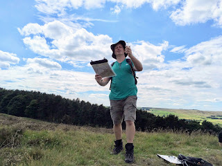
| Difficult navigation on featureless terrain - Navigation Masterclass |
 |
| Quality Day on Kinder Scout |
After joining the
Pennine way which we followed for 300m, we continued off path navigating to
obscure pools and spot heights; via Over Wood Moss before reaching the shelter
and welcome respite of Oyster Clough shooting Cabin.
The navigation
involved following compass bearings along broad snow clad ridges estimating
time and distance from one broad summit to another, all the time in snow and
battling against winds of 40 mph.
Not all of our courses
are held in such challenging conditions and we run a range of courses for
people at all levels of experience including the National Navigation Award schemes. Our navigation courses are as follows:
 |
| 1st Steps to Map Reading and Navigation Course |
A course designed for beginners who will mainly be walking through fields or easy moorland.
Although a beginners
course, covering the basics, this course spends less time in the class room and
fields and concentrates more on moorland walking. Suitable for fit beginners.
Suitable for those who
already know the basics of navigating using a compass but introduces more
advanced techniques on difficult moorland and steep terrain. Pacing, timing,
contouring; finding 5 obscure aircraft wrecks on Kinder Scout.
 |
| Night Navigation Course |
These are days for
experienced navigators who want to be involved in planning and navigating
around challenging courses helping to refine and develop their navigation
skills.
 |
| Learning Map Reading and Navigation |
The Silver
training and assessment will follow our Introduction to Moorland
Navigation (based from Foolow) and Intermediate Navigation (on Kinder Scout),
though there will be a formal route planning exercise introduced for NNAS
candidates which is currently not compulsory for people attending the
Intermediate course.
If the take up of courses is as good as we expect
then we will introduce Gold NNAS training and assessment in 2014 though this
will be based in the Lake District.
Peak Navigation Courses are run by Jane Livingstone and Michael Hunt, both qualified International Mountain Leaders. Jane and Michael also run walking holidays as Mountain House Holidays and from their base in Spain operate as Sierra Nevada Guides.
Peak Navigation Courses are run by Jane Livingstone and Michael Hunt, both qualified International Mountain Leaders. Jane and Michael also run walking holidays as Mountain House Holidays and from their base in Spain operate as Sierra Nevada Guides.