Posts

Showing posts with the label Peak District Navigation Courses

Why do I Need a Map Reading and Navigation Course when I have my mobile phone?
Image
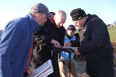
In the last few days, I have watched 2 couples out for walks in the Peak District struggling to follow a route using a mobile phone. The first was on a fairly isolated bit of moorland; the weather was not the best, and we had just finished talking with our 4 clients about safety and using a compass on the moor where people have got lost in bad weather.    The couple concerned spent a good 10 minutes looking at their phone, trying to work out where they were and then wanted to get to.    As we returned to our cars, we met them again on the road - they had presumably walked to the far side of the moor, then joined the road for a mile or so.    They could have had a lovely off-path walk round the moor, much nicer than the road, had they had the skills to work this out for the map. Today I met another couple in our village, looking for a footpath. They asked a neighbour where to go, but a few minutes later had hardly moved and still looking perplexed so I gave ...

Choosing a compass to get the best out of your Peak Navigation Course

Image
At Peak Navigation Courses , we pride ourselves in our compass navigation, getting a real thrill out of sharing map and compass navigation techniques with others Whether you are a complete beginner or joining one of our advanced navigation courses where we use the compass to cross Kinder Scout, choosing the best compass for you can be a real minefield. Go to one of the outdoor or online shops and you will find a sometimes bewildering array of different compasses, so which is best, and how do you choose? If you are a new hill walker, or never used a compass before, a cheaper model is often appealing.  You can pick a compass up from an online shop for a couple of pounds, but is it worth it? Highlander Summit As a starter compass, this may seem appealing, it is light, easy to carry and will point north. However the plastic base is very short, and lacks an arrow to show which direction you should walk - not one we would recommend. Vango DLX0 The Vango DLX is a reas...

How to use a Compass

Image
How to use a compass A compass is a simple and brilliant navigation tool.  At the very least it will have a needle that points north which will allow you to orientate your map and give you a rough indication of which way to walk.  If you have one designed for hill walking, mountaineering and orienteering then you will have "the full monty" and be able to use it for accurate map reading and navigation.  The compass used to illustrate this blog is a Silva type 4 Expedition (not the military version) and is a great all round compass. In this short feature I can't teach you all of the techniques involved in navigation but will show you how to use a compass to navigate across a short stretch of open moorland from a known point (where you are) to another point (where you want to go). Step 1: I want to navigate from the Trig Point 590m to Madwoman's Stones. Step 2: Lay the edge of the compass across the Trig Point 590m and Madwoman's ...

Wind Chill and Lapse Rate in British Mountains

Image
Wind Chill and Lapse Rate Walking from my house situated at 300m a.s.l. in the Peak District today I was struck by how cold and damp it was. O.K. it’s January in the U.K. but it felt really cold. Suitably dressed for a cold day navigating on Kinder Scout There are two common factors that have an effect on the temperature whilst walking in British Hills. Wind Chill and the Lapse Rate. Why do we do it? 1.             Lapse Rate A lot has been written scientifically and in depth about Lapse Rate. There is a good paper from Bangor University.  However it is essentially the amount that air temperature decreases as you gain altitude. Although there are variables such as whether the air is dry or saturated, generally the temperature decreases around 6.5 degrees C per 1000m climbed. So for example if you were in Snowdonia, let’s say in Bangor at Sea Level and you were walking to Snowdon via Llanberis. ...

Map Reading for Mature Walkers

Image
Map Reading for Mature Walkers At Peak Navigation Courses we are seeing an increasing number of “mature” walkers attending our map reading and navigation courses. People come into walking for various reasons, some are taking it up in retirement, others come via the “walks for health” programme though many have walked as part of a group for many years but have always followed others and now want to plan and follow their own routes.   Whatever your reason for wanting to learn to read a map and navigate, Peak Navigation Courses have a course to suit you. This is why we are introducing a course specifically for mature walkers who want to enjoy walking paths and lanes at a slower pace rather than crossing open moorland. Map Reading for Mature Walkers is a one day course that starts with the very basics though by the end of the day aims to leave you confident to plan a route and follow it using a range of map reading and navigation techniques including using a c...

Silver National Navigation Award in a Weekend

Image
Silver National Navigation Award in a Weekend Learning to navigate in the snow Peak Navigation Courses ran a Silver NNAS course over the Easter weekend for Natural Born Hikers, a “Meet Up” group from London. Ten students in total attended the weekend which was staffed by Jane, Mike and Steve from Peak Navigation Courses.   Normally the Silver NNAS is just a two day course but being Easter the course was extended so that after the Silver NNAS, we included a night / poor visibility navigation session on Big Moor and looked at some more advanced navigation techniques on Kinder Scout. All ten students achieved the standard and had a great time. Night Navigation on Big Moor   Peak Navigation Courses have a programme of Navigation Courses, either 1 day or 2 day (NNAS) based in The Peak District throughout the year. Day courses are priced from £40 per person whilst the 2 day NNAS courses are £85 per person. The courses run by Peak Navigation Co...

More Navigation in the Snow!

Image
More Navigation in the Snow! Peak Navigation Courses run a series of “Quality Days“ or Navigation Master classes aimed at allowing people who can already navigate the chance of some more testing navigation in remote locations. Last Sunday’s course certainly proved that in snowy conditions on Bleaklow with high winds and wind chill temperatures estimated to be -8 degrees (though I thought colder). Setting off from Birchin Clough car park we ascended Lady Clough before crossing the Snake Road onto Bleaklow via Upper North Grain. Difficult navigation on featureless terrain - Navigation Masterclass Quality Day on Kinder Scout Specifically we practised pacing and pacing in snowy conditions where there is a significant loss of traction requiring more paces to 100m. After joining the Pennine way which we followed for 300m, we continued off path navigating to obscure pools and spot heights; via Over Wood Moss before reaching the shelter and welcome respite of Oyster...

NNAS Course Dates and Prices 2013, by Peak Navigation Courses

Image
Peak Navigation Courses Dates for our NNAS training and Assessment Courses 2013. Peak Navigation Courses have now finalised the dates for their NNAS courses in 2013. Our cost for these 2 day NNAS Courses is £85 (non residential). Learning to use a compass Bronze NNAS:              25 th and 26 th May 12 th and 13 th October 9 th and 10 th November both days based from Foolow  in the Peak District Silver NNAS:                          1 st and 2 nd June 19 th and 20 th October 16 th and 17 th November day 1, based from Foolow;   day 2, near Edale For the Bronze and Silver courses, you don’t have to commit to a whole weekend, you can mix and match the dates to suit you,     i.e. for bronze you could have day 1 on 25 th May and day 2 on 13 th October. Go...

NNAS Courses being run by Peak Navigation Courses

Image
NNAS Courses being run by Peak Navigation Courses Peak Navigation Courses are pleased to now be delivering NNAS (National Navigation Awards) in The Peak District.   We have recently been accredited as NNAS trainers and will be adding a full list of courses into our autumn programme.   It will however be possible to gain the silver award by arrangement (completing both our Introduction to Moorland Navigation Course and our Intermediate Navigation Course with some assessment built in). Locating our position on the map The Bronze training and assessment will be a two day course based from the village of Foolow.   The two days can be consecutive or spaced out over different weekends.   Day one being our normal 1 st Steps to map reading and navigation course but day two being a newly devised day specific to the bronze syllabus and allowing time for assessment. Learning to use a compass The silver training and assessment will follow the pre...