Posts

Showing posts with the label Navigation Skills

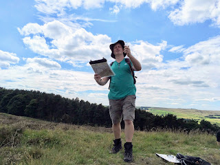
Why do I Need a Map Reading and Navigation Course when I have my mobile phone?
Image
In the last few days, I have watched 2 couples out for walks in the Peak District struggling to follow a route using a mobile phone. The first was on a fairly isolated bit of moorland; the weather was not the best, and we had just finished talking with our 4 clients about safety and using a compass on the moor where people have got lost in bad weather.    The couple concerned spent a good 10 minutes looking at their phone, trying to work out where they were and then wanted to get to.    As we returned to our cars, we met them again on the road - they had presumably walked to the far side of the moor, then joined the road for a mile or so.    They could have had a lovely off-path walk round the moor, much nicer than the road, had they had the skills to work this out for the map. Today I met another couple in our village, looking for a footpath. They asked a neighbour where to go, but a few minutes later had hardly moved and still looking perplexed so I gave ...

Choosing a compass to get the best out of your Peak Navigation Course

Image
At Peak Navigation Courses , we pride ourselves in our compass navigation, getting a real thrill out of sharing map and compass navigation techniques with others Whether you are a complete beginner or joining one of our advanced navigation courses where we use the compass to cross Kinder Scout, choosing the best compass for you can be a real minefield. Go to one of the outdoor or online shops and you will find a sometimes bewildering array of different compasses, so which is best, and how do you choose? If you are a new hill walker, or never used a compass before, a cheaper model is often appealing.  You can pick a compass up from an online shop for a couple of pounds, but is it worth it? Highlander Summit As a starter compass, this may seem appealing, it is light, easy to carry and will point north. However the plastic base is very short, and lacks an arrow to show which direction you should walk - not one we would recommend. Vango DLX0 The Vango DLX is a reas...

Choosing a Navigation Course

Image
Peak Navigation Courses,   Which is the Right Course For   Me? At Peak Navigation Courses we want you to have the best learning experience and select the right course so that you get the greatest benefit. Hopefully this Blog will answer your questions.  We run a range of stand alone courses in both traditional (map and compass) navigation and some 1:1 training to get you started with your GPS. Additionally, our Introductory Course (1st Steps to Map Reading & Navigation) can be combined with our Intermediate Course (Moving onto Moorland) to become the Silver National Navigation Award. Intoductory Course - 1st Steps to Map Reading & Navigation Prior Experience.             None required. Classroom based with 2 short walks of 1.5 hours and 2 hours. Terrain encountered.             Paths, fields and some rough pasture on easy mo...

Foreign Maps

Image
BL***Y Foreign Maps Mike and Jane from Peak Navigation Courses spend the summer months guiding people in the mountains. This summer will see us in Spain’s Sierra Nevada, Swaziland, Mozambique, Scotland and Slovenia. As International Mountain Leaders we are trained and assessed at using all sorts of foreign maps.   We have a lot to be thankful for in the U.K. as our Ordnance Survey maps are perhaps the best in the world. It also makes navigation easier with good maps and makes for safer enjoyment in the mountains. Map extract - Spain's Sierra Nevada In the UK our maps show crags and rock features. This is especially useful as you wouldn’t want to take a line over a cliff.   The map above is from Spain’s Sierra Nevada.   From the contour lines it appears that these are nice rounded hills with no crags at all.    The cliffs at point A on the map The next pictures below show Jane climbing / scrambling at points A and B on the map! Not...

A Glorious Night Out!

Image
A Glorious Night Out! The weather over the past weekend was one of forecasts for heavy rain and flooding across the country. Amidst this Peak Navigation Courses still managed to run a successful night navigation course that was acclaimed as brilliant by the students attending! “Thanks for last nights night nav session. Really enjoyed it!”   Ashley Dawson Night Navigation, planning strategies The night navigation courses are really designed for people who already have good navigation skills and are able to use a map and compass to cross open moorland. What they aim to achieve is to introduce the necessary strategies to cope in poor visibility simulating what happens should the mist come down or should you get caught out after darkness. Hopefully the course will leave students confident to get out and practice for themselves (practice makes perfect!). The course we run starts at 6.30pm during the winter months and involves a practical session of around three h...

Kinder Scout claims more scalps!

Image
Autumn has arrived early this year as we didn’t seem to have much of a summer. Looking at the mountain rescue call out reports, the Peak District moors have certainly been proving too much for many ill prepared walkers who have ended up having to be rescued.   It’s not just about poor map reading and navigation skills and the over reliance on GPS navigation technology, but also about having the skills, clothing and equipment to deal with the difficult terrain, which has become extremely boggy after the summer rains.  The Following is an extract from Buxton Mountain Rescue Team call out log: “ Buxton Mountain Rescue Team called out as night fell to search Kinder moor for two walkers who were trapped by deep bog without lights or whistle.   Although the casualties, a married couple from Doncaster, had no apparent injuries, they were very cold and disorientated. The night was damp and misty at high level, with some wind. They had set off for a days walk from E...